
Walk a Mountlake Terrace Street
A sound street directory search moves from the place to the records, then tests what each record actually says. Begin with the address exactly as used today. If that fails, remove the street type or directional and try the county examples, such as a street name alone or a number followed by a wildcard. The aim is to identify the parcel before searching people. Parcel data is the common key that connects the assessor, map, permits, plats, and recorded documents.
- Enter the street address in the Snohomish County Property Search. Record the parcel number and situs address, meaning the physical location.
- Open SCOPI, click the parcel, and compare the lots next to it. Note any shared-interest or multiple-parcel flag.
- Check the Mountlake Terrace eTRAKiT property search for permit, inspection, land-use, and legal-description tabs.
- Use the parcel ID or legal description in the county recorded-document index. Read deeds, plats, and surveys as dated property events, not occupancy proof.
- For an older household, consult the Polk address index and then its matching alphabetical entry. Verify the year and whether that volume covers Mountlake Terrace.
This sequence separates current assessment facts from later inferences. A listed owner may live elsewhere. A permit applicant may be a contractor. A directory name belongs to the year printed, not today. The Mountlake Terrace street directory becomes more reliable when every hit keeps its original role.
Mountlake Terrace Address Search Fields
The county assessor offers two useful routes. Property Search takes a parcel number or a street address. Sales Search adds filters for Mountlake Terrace and ZIP 98043, along with date, price, area, and use-code controls. The basic property screen did not expose a verified owner-name field, so an address-led search should not promise one. Fewer address details often return a broader and more useful set.
| Portal field | Input | How to use it |
|---|---|---|
| Parcel Number | Fourteen digits for real property | Use the current parcel key; historic cards may also require an old number. |
| Property Street Address | Street name, full address, or wildcard | Try the name alone, a full form, then a partial number such as 123*. |
| Sales Search City | Mountlake Terrace | Filters county sales results by the city value supplied by the portal. |
| Sales Search ZIP | 98043 | Provides a postal filter, not proof that every result lies within city limits. |
| SCOPI parcel click | Map selection | Returns parcel, property address, owner, and a route to account details. |
The official Property Search screen shows how a Mountlake Terrace address is entered.
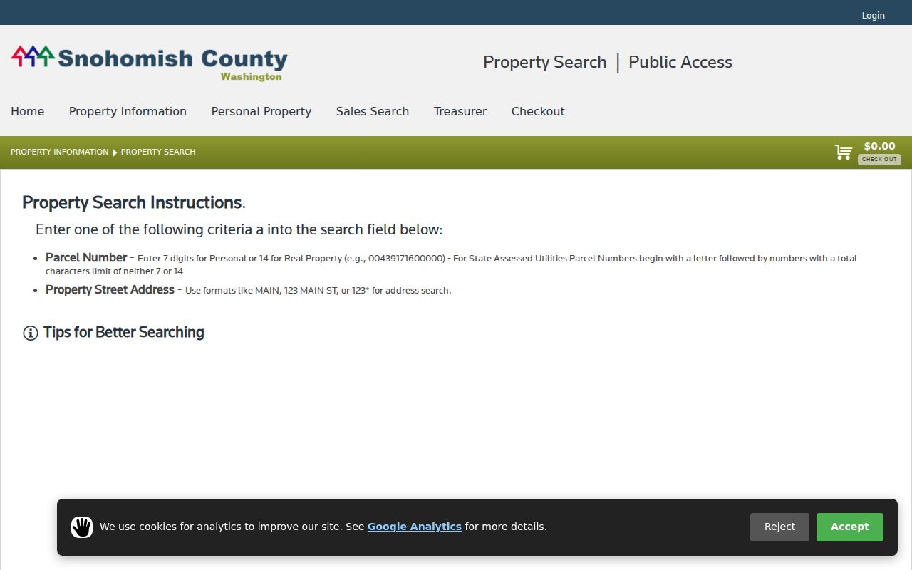
The captured form confirms the address and parcel routes used in the street-by-street workflow.
For a wider set, the county Sales Search criteria supplies the city and ZIP filters.
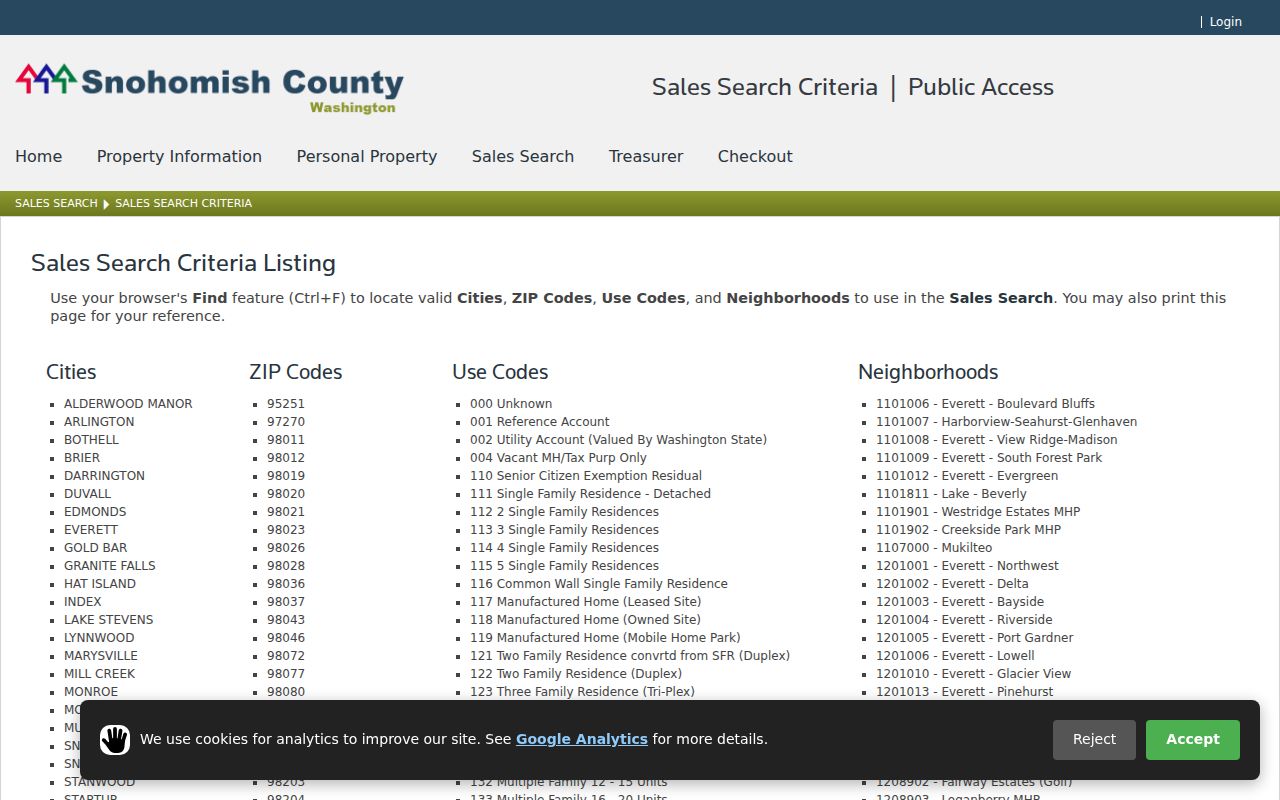
Those filters help group parcel sales, but they do not identify all people at an address.
Map Mountlake Terrace Street Parcels
SCOPI, the Snohomish County Online Property Information map, lets a reader pan, zoom, and click parcels along the same block. A selected parcel can show the parcel ID, property address, and owner. The result list may add taxpayer, gross acres, market value, and tax-code area. Property Account Summary can lead to sales history, tax history, legal description, and structure data. These are parcel facts. They do not establish who sleeps in the building.
The map has two traps worth checking. “Multiple Parcels” can mean one visible site is tied to more than one parcel ID. “Shared Interest Parcels” can alter the gross-acre figure. County guidance also says that “Not a Legal Tax Parcel” may describe a gap where legal descriptions do not meet. Capture all related parcel IDs before moving to a deed or plat.
The SCOPI guidance page explains the parcel layers and result labels used by this street directory.
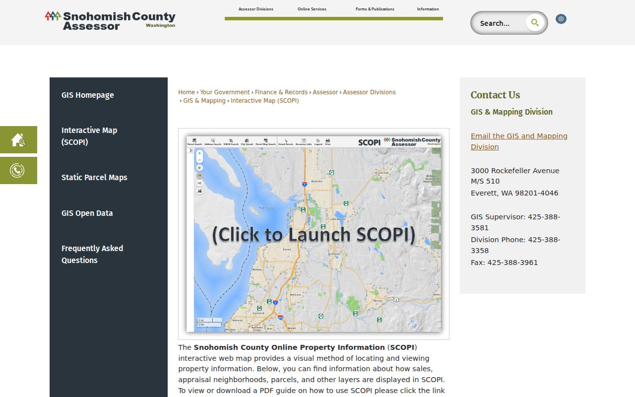
The guidance also warns that the map is illustrative, not an official survey or legal citation.
- Parcel
- A tax and land-record unit identified by a county number. One site can involve more than one parcel.
- Situs address
- The physical property address, which may differ from the owner or taxpayer mailing address.
- Plat
- A recorded map that divides land into lots, blocks, streets, and easements.
- Criss-cross directory
- A printed directory arranged by address, allowing a historical street-to-name search.
Note: SCOPI aerial layers are dated evidence of visible land and structures, not proof of occupancy, permits, or legal boundaries.
Mountlake Terrace Street Record Layers
No single Mountlake Terrace street directory contains every owner, occupant, permit, or past household. The best result is a dated stack of records. The assessor and SCOPI anchor the parcel. Recording documents show transactions. City permits show work tied to the site. Printed directories can name a historical householder when the correct volume covers the community.
| Address record | Custodian | What it can show | Access route |
|---|---|---|---|
| Assessment account | Snohomish County Assessor | Parcel, situs, listed owner, taxpayer, value, legal description | Property Search, SCOPI, assessor contact |
| Deed, plat, survey | County Auditor Recording Division | Named transaction parties, ARN, date, parcel or legal description | Online index; Everett terminal; mail and microfilm |
| Permit and inspection | Mountlake Terrace | Property, project, inspection, violation, and applicant roles | eTRAKiT; city records request |
| Historic field book | County Assessor | Old and new parcel numbers, field card, possible image | Online 1970-1999 collection; assessor fallback |
| Polk address index | Everett Northwest Room | Dated address-to-householder entry where coverage exists | Library volume and staff help |
| Voter record | VoteWA and Elections | A registrant's own current registration | Self-lookup only; not a by-street directory |
VoteWA requires a matching first name, last name, and birth date. It cannot be used to fill gaps on a Mountlake Terrace block. County voter data also routes to the Secretary of State under current rules and remains subject to statutory limits. Property and historical sources are the safer street-led channels.
Mountlake Terrace Deeds by Address
The Recording Division indexes deeds, deeds of trust, reconveyances, leases, liens, plats, surveys, and other instruments. Use the parcel ID from the assessor when an address is not a direct search field. The county search supports name, document type, ARN, recording date, parcel ID, book and page, and legal description. A grantor transfers an interest; a grantee receives it. Neither label proves that the party lived on the property.
Most recorded documents from July 1976 forward are online. A free account has been required since March 2, 2026. For an older deed, use public terminals and staff help at the Recording Division in Everett or send a detailed mail request. Significant or pre-1976 research may cost $8 per hour. Ordinary, downloaded, and certified copies are different products; the county says certified copies carry the Auditor seal and a true-and-correct-copy date and signature.
The recorded-document search instructions show the current account and access process.
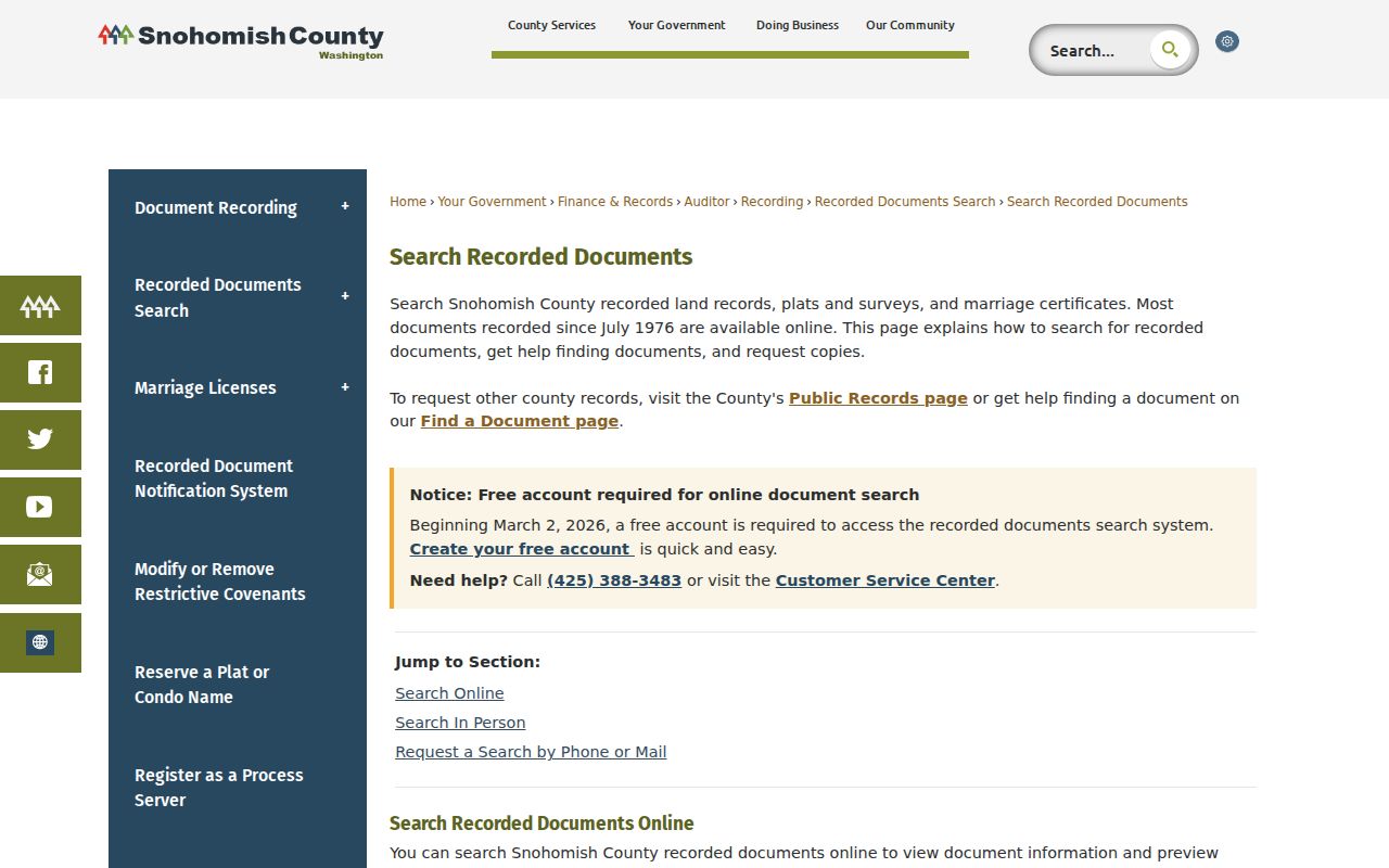
The portal image supports the online step, while the counter, mail, microfilm, and copy form remain vital fallbacks.
Mountlake Terrace Permits by Street
City permits add a different kind of address evidence. The eTRAKiT property search accepts a search field, operator, and value, then exposes parcel, owner, restrictions, land use, building, legal description, and inspection tabs. Permit, project, inspection, violation, and complaint modules can show what happened at a site and when. An applicant or contractor named in a file is not automatically an owner or resident.
The Mountlake Terrace eTRAKiT property form is the city-level companion to the county street directory tools.
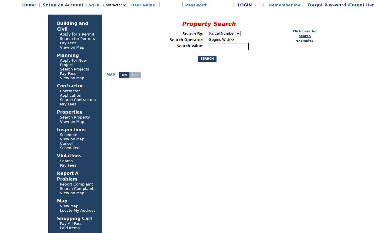
The screen confirms the address and parcel search path for permits and inspections.
When a file is missing online, send a narrow request through Mountlake Terrace Public Records. The city accepts portal, mail, email, in-person, and phone requests. Name the department, record type, address or parcel, date range, and preferred format. Under RCW 42.56.520, the city responds within five business days by providing records or a link, acknowledging with an estimate, seeking clarification, or denying with an exemption citation.
Note: Permit timing and portal coverage can change, so save the query date and ask the city for a dated file when needed.
Older Mountlake Terrace Street Clues
Historic assessor field books cover 1970 through 1999 and can bridge current and old parcel numbers. The parcel format changed in 2000 even though the number stayed fourteen digits long. Search the new number, old number, and archival box number. Some scans may include a picture. A “No Results” message means the web collection did not return a card; it does not prove that no paper record or prior owner exists.
The historical assessor search shows the fields available for older Mountlake Terrace street records.
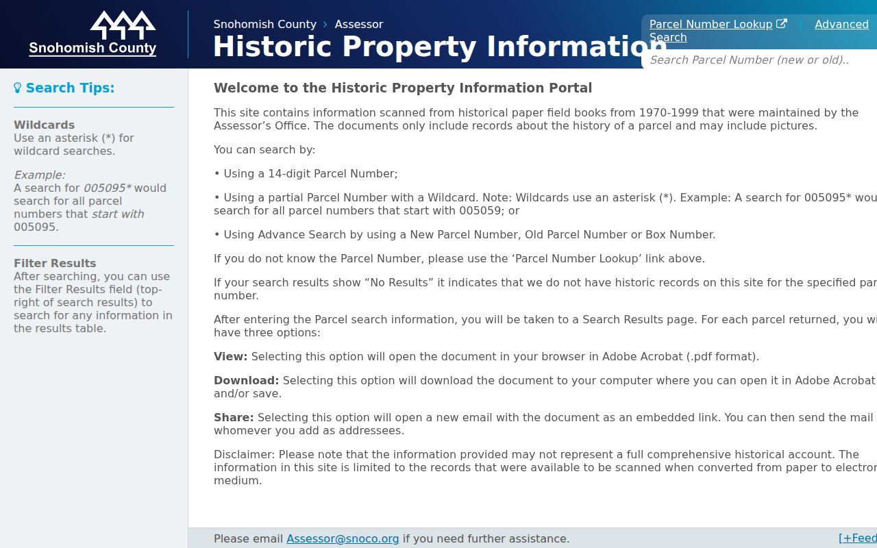
This field-book route is useful when the current parcel number will not connect cleanly to an older deed or directory year.
Polk directories run from 1893 through 1999, with an address index beginning in 1932. Early volumes include some communities outside Everett, but Mountlake Terrace coverage must be checked volume by volume. Cole directories begin in 1980 and are name-only. The regional collection is explained in the Mountlake Terrace city directories resource; use it as a dated supplement, not a current street roster.
Mountlake Terrace Grid Changes
Mountlake Terrace code describes an organized address grid and gives Community and Economic Development responsibility for street names and addresses. No official citywide renumbering year was found. Therefore, an old number should be tested through street-type and directional variants, parcel and legal description, subdivision plat, and city archive records. Do not assume that today’s number existed in the same form.
The city incorporated on November 29, 1954. A broader regional map lists annexations from 1962 through 1999, but no parcel-level conversion table was located. For a record predating incorporation or annexation, check the legal boundary and county context instead of adding “Mountlake Terrace” to a source that did not use it. ZIP 98043 is a postal clue, not a city-limit polygon.
A local history clue sits at 220th and 70th, where official anniversary material places John Fluke Corporation in 1959. That intersection can help a civic or street-history search in the city archive. It must not be treated as a personal residence. The same rule applies to place names such as Melody Hill, Cascade View, and Lake Ballinger.
Mountlake Terrace Street Aerial Dates
SCOPI adds a useful time layer to an address search. County guidance identifies 2024 urban imagery captured from March 31 through May 31, with older layers from 2022, 2021, 2020, 2018, and 2017. Compare the same parcel across dated layers when the question concerns a visible structure, cleared lot, street connection, or nearby land change. Record the layer year with every observation.
An aerial image can show what was visible from above on a capture date. It cannot prove who lived there, when construction was approved, where a surveyed boundary lies, or whether a use was lawful. Pair a visible change with the parcel account, recorded plat, and Mountlake Terrace permit file. For roads or lots near an annexed area, also check the city boundary record that applied on that date.
This is an insider advantage of the county map: a street directory result gains a dated physical cross-check without turning the image into a resident claim. If a roofline or lot shape differs, treat that as a prompt to search permits and deeds, not as a final answer.
Note: Cite the aerial capture year and county disclaimer whenever a map image helps explain a change along a Mountlake Terrace street.
Mountlake Terrace Street Privacy Limits
A street directory cannot name every renter, child, roommate, visitor, utility customer, or person using a protected address. The assessor describes a parcel relationship, not a household. Voter access is not a public by-address search. Court, police, vital, and custody records carry their own redaction and access rules and should not be joined merely to complete a street roster.
Washington’s Address Confidentiality Program gives qualifying people a substitute mailing address and keeps the actual address confidential. If a source signals ACP, a sealed record, victim protection, or another restricted address, stop the search. Do not use another public source to defeat that protection.
Lawful use. Use Mountlake Terrace address records for family history, property research, civic questions, or scam prevention. Never use them to stalk, harass, threaten, or target a person.
Commercial people-finder data can be stale, merged, or stripped of its source date. Official records are stronger because the custodian and record role remain visible, but even an official owner field can be old or misunderstood. Save the URL, custodian, query, access date, record date, copy status, and confidence level for every result.
Note: A missing portal result documents a source limit; it does not prove that a person or property record never existed.